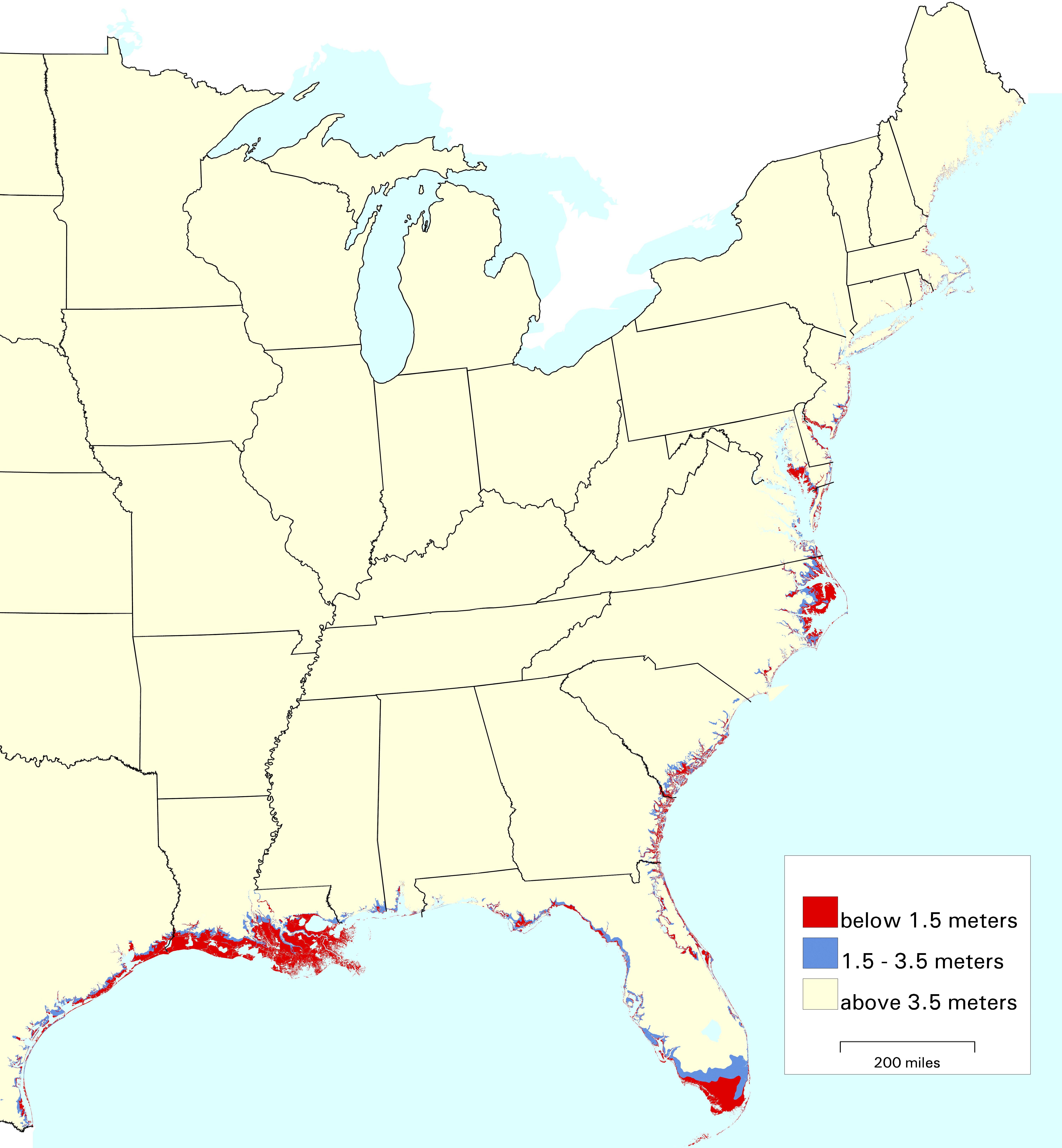
Maps of Lands Vulnerable to Sea Level Rise
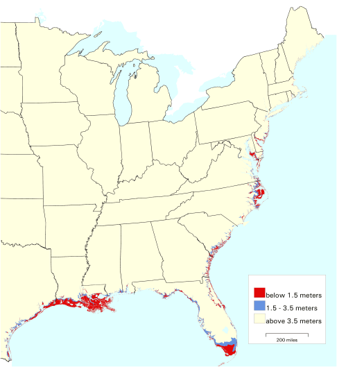
Data courtesy Maps of Lands Vulnerable to Sea Level
Rise: Modeled Elevations along the U.S. Atlantic and Gulf Coasts (PDF) (34 pp., 714 KB,)
CLick here for a print-quality version of this sea level rise map (JPG 1.49 MB)
To the Sea Level Rise Maps page.