- Causes of Future Sea Level Rise
- Elevation Maps
- Will we really lose all that land?
- Sea Level Rise Planning Maps
 6.1 The Rolling Design Boundary
6.2 Restrictions Imposed by the Rolling Easement
6.2.1 Seaward of the Rolling Design Boundary
Whether by regulation or interest in land, the most essential part of a rolling easement is the set of rights transferred from the coastal landowner to the local government or land trust. Seaward of the boundary, the rights potentially altered concern:
|
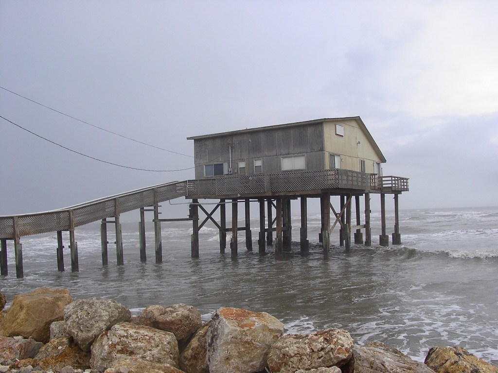
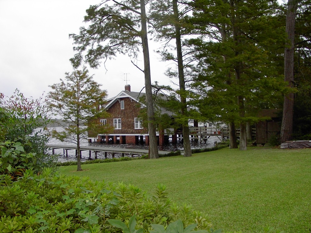 Photos 38 and 39. Homes standing in tidal waters. A rolling easement would not necessarily require immediate
removal of homes seaward of the rolling design boundary. Left: Gulf of Mexico, near Surfside, Texas (March 2006).
Right: Forbes Bay, Elizabeth City (October 2002). Photo source: ©James G. Titus, used by permission..
Photos 38 and 39. Homes standing in tidal waters. A rolling easement would not necessarily require immediate
removal of homes seaward of the rolling design boundary. Left: Gulf of Mexico, near Surfside, Texas (March 2006).
Right: Forbes Bay, Elizabeth City (October 2002). Photo source: ©James G. Titus, used by permission.. |
- Limits on shore protection;
- Ban on shore protection structures,
- Allow grade elevation?
- Allow beach nourishment?
- Material for grade elevation (if allowed);
- Ban on new structures of any type;
- Excavation;
- Removal of structures (stated period of time before structures must be removed)
- Homes and other primary buildings,
- Utility buildings,
- Structures that alter shoreline processes whether or not originally intended as shore protection (e.g., retaining walls, driveways)
- Other structures;
- Management of structures (before removal is due)
- Repair rules,
- Access rules,
- Rules for relocation within parcel,
- Timing for removal,
- Rules on who can use them,
- Rent for the temporary continued use;
- Transfer of title (in the case of interests in land);
- Public access (in the case of rolling easements intended to ensure access);
- Permissible uses once the land becomes submerged (in areas where submergence does not transfer title to the state public trust);
This list highlights two key decisions: (1) whether to prevent all shore protection or just shoreline armoring; and (2) whether and when to require removal of buildings. Existing rolling easement policies generally allow ocean beach nourishment because adding sand to the system can offset erosion without impairing access along the beach. But placing soil onto wetlands can destroy them; and grade elevation inland of the wetlands prevents them from migrating inland. A rolling easement can be designed to remove buildings as soon as the building encroaches seaward of the rolling boundary or as late as never, with many possibilities in between. The timing of the required removal could depend on both the objective of the rolling easement and the logistics of removing homes and businesses from developed areas.
Removal of homes need not be the goal of every rolling easement. A community's plan might be to follow the accommodation pathway rather than retreat, in which case allowing homes to remain when an area becomes marsh or open water would be consistent with the plan (see Photos 38 and 39). Similarly, a key objective might be to ensure that low-lying waterfront owners do not elevate land or build dikes in ways that would slow drainage and increase flooding of adjacent lands that are slightly higher. Finally, even in an area where the ultimate goal is to retreat, a local government or land trust might assume that it lacks the resources or political ability to eject people from their homes, and prefer to let the state resolve this issue once the land is seaward of the public/private boundary; that eventuality would be ensured by the prohibition of shore protection. In all these cases, the rolling easement makes an eventual retreat more likely without actually forcing it to occur.
|
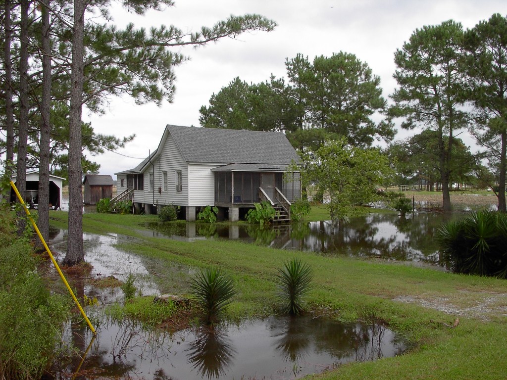
 Photos 40 and 41. Restrictions on grade elevations might need an exception for driveways.
|
Even if the purpose of the rolling easement is to ensure that the entire footprint of human activities moves inland, some flexibility in the timing can reduce litigation costs, and help the landowner more than it harms the environment. Especially along a south-facing shore, marsh grasses can grow next to and even under a home elevated 10 to 12 feet above spring high water. Even if the home did impair marsh grasses, it might cover a very small part of the parcel. Yet to the landowner, continuing to have the home until his children (or grandchildren) are grown could make the required relocation far more palatable. If a storm destroys the house in the meantime, an owner is generally more willing to accept the need to move than if ejected by a court, and the economic damages attributable to the rolling easement are much less.[509] These reasons for not immediately ejecting the owner when the property encroaches seaward of the rolling boundary do not necessarily mean that the flexibility should be in the original easement document. It may be more efficient for a rolling easement to have a specific requirement to remove the home once there is an encroachment, and then allow for renegotiation of the terms, if both parties agree, once submergence becomes imminent.[510]
6.2.2 Landward of the Rolling Design Boundary
The objective of a rolling easement is to ensure that resources seaward of the rolling boundary can migrate inland. But the uses of land that is inland of that boundary matter because that land will eventually be seaward of the boundary. Rights landward of the boundary that might be transferred include:
- Restrictions on grading;
- No grading that increases land elevation,
- Limited to a fraction of the property?
- Allowed for driveway (Photos 40 and 41)?
- No foreign material brought in for grading,
- No additional drainage ditches (which can allow saltwater into soils),
- Excavation allowed to lower grade to create wetland habitat?
- Restrictions on construction;
- No construction within a specified distance landward of the rolling easement boundary,
- Design specifications for mobility, dismantling, or returning to nature without removal;
- Vegetation management;
- No trees with large roots (whose degradation can cause subsidence),
- No shade trees,
- No fertilizer, and
- Limits on species of domestic animals allowed.
Most important is prevention of activities that tend to nullify the rolling easement. If the goal is landward migration of wetlands, then increases in the elevation grades of the dry land would be, in effect, a form of shore protection. Some adjust-ments of grade may be needed for the temporary uses of land, such as leveling a roadway (see Photos 40 and 41) or installing an advanced septic system in an area with a high water table. Restricting foreign (off-site) material for grading would prevent the average grade from being elevated and would maintain the preexisting soil type.
The premise of a rolling easement is that the owner will continue to use the land in a way consistent with an eventual retreat. The owner is assumed to be in a better position than the government or land trust to judge whether an investment with a limited useful life is worthwhile. Thus, the greater the restriction on construction landward of the boundary, the more the restriction resembles a setback rather than a rolling easement. Nevertheless, a rolling setback may be needed to preserve the integrity of the rolling easement. Buildings[511] or septic systems,[512] for example, are often set back from wetlands 50–150 feet; hence a rolling easement might require relocation of septic systems within 50–150 feet of the easement boundary or prohibit repairs to any system likely to be within 50–150 feet during the typical lifetime. Moreover, the drain fields from septic tanks generally must be at least 18 inches above the water table to perform properly,[513] so a rolling easement might require relocation or replacement with another type of system once the water table reaches a particular elevation (see Photo 42).[514]
|
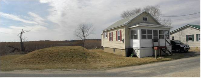
| Photo 42. Mounds-based septic system next to house. Along the back side of Pickering Beach, Delaware (March 2009). Photo source: ©James G. Titus, used by permission. |
[509] The cost of post-storm relocation would only be the cost of vacant land, rather than the cost of land and structure.
[510] See infra notes 595–596 and accompanying text.
[511] See, e.g., CCSP supra note 3, at 214 (Delmarva Peninsula) and 226–227 (Chesapeake Bay).
[512] Town of Duxbury, Massachusetts, Supplementary Rules & Regulations to the State Environmental Code: Title 5, 310 CMR 15.000 (150 feet from wetlands).
[513] See, e.g., CCSP supra, note 3, at 174–75.
[514] The most common alternative system involves building a small mound, so the parties would have to consider whether allowing the minor grading for such a system would be preferable to the alternatives. See, e.g., CCSP, supra note 3, at 174–175.
This page contains a section from: James G. Titus, Rolling Easements, U.S. Environmental Protection Agency. EPA‑430‑R‑11‑001 (2011). The report was originally published by EPA's Climate Ready Estuary Program in June 2011. The full report (PDF, 176 pp., 7 MB) is also available from the EPA web site.
For additional reports focused on the implications of rising sea level, go to Sea Level Rise Reports.